Mapping the Full Water Column | WGI Whitepaper
WGI Hydrographic Survey Vessel on the Illinois River
Technical Whitepaper

MAPPING the FULL WATER COLUMN

Why Modern Hydrographic Surveys Require Multi-Sensor Integration

America's water infrastructure is facing its largest federal investment in a generation — and every project depends on accurate bathymetric data. This paper examines why single-method survey thinking fails complex aquatic environments and what multi-sensor integration actually delivers.

$17B+
Federal IIJA Water Investment
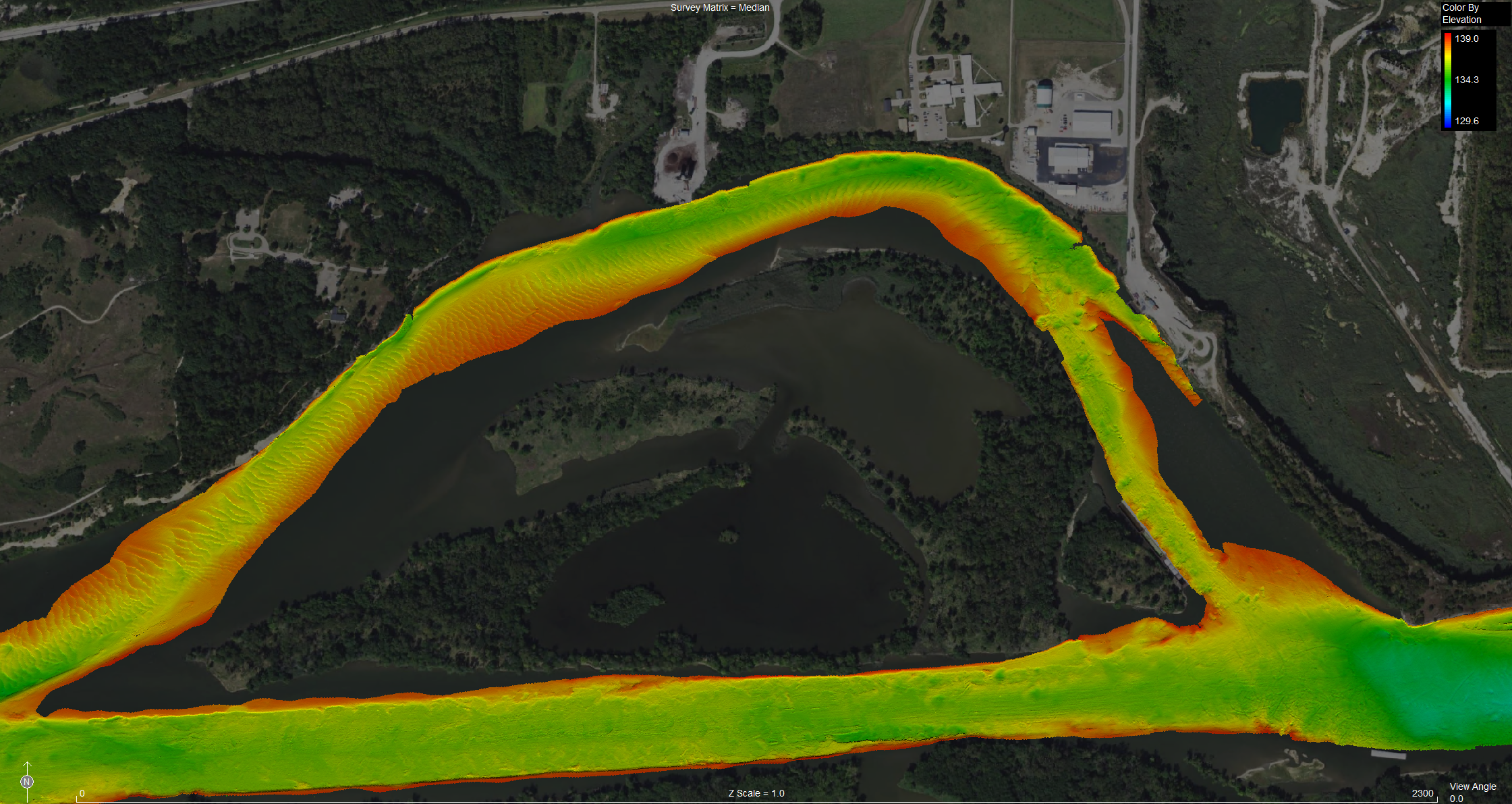
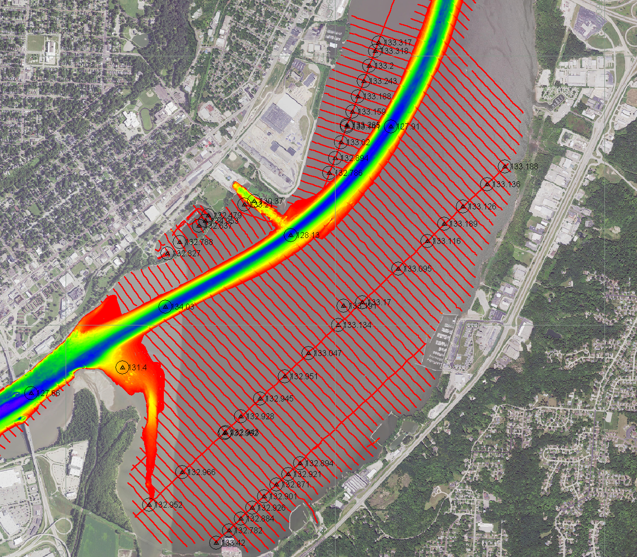
356 mi²
Illinois River Survey Area
4
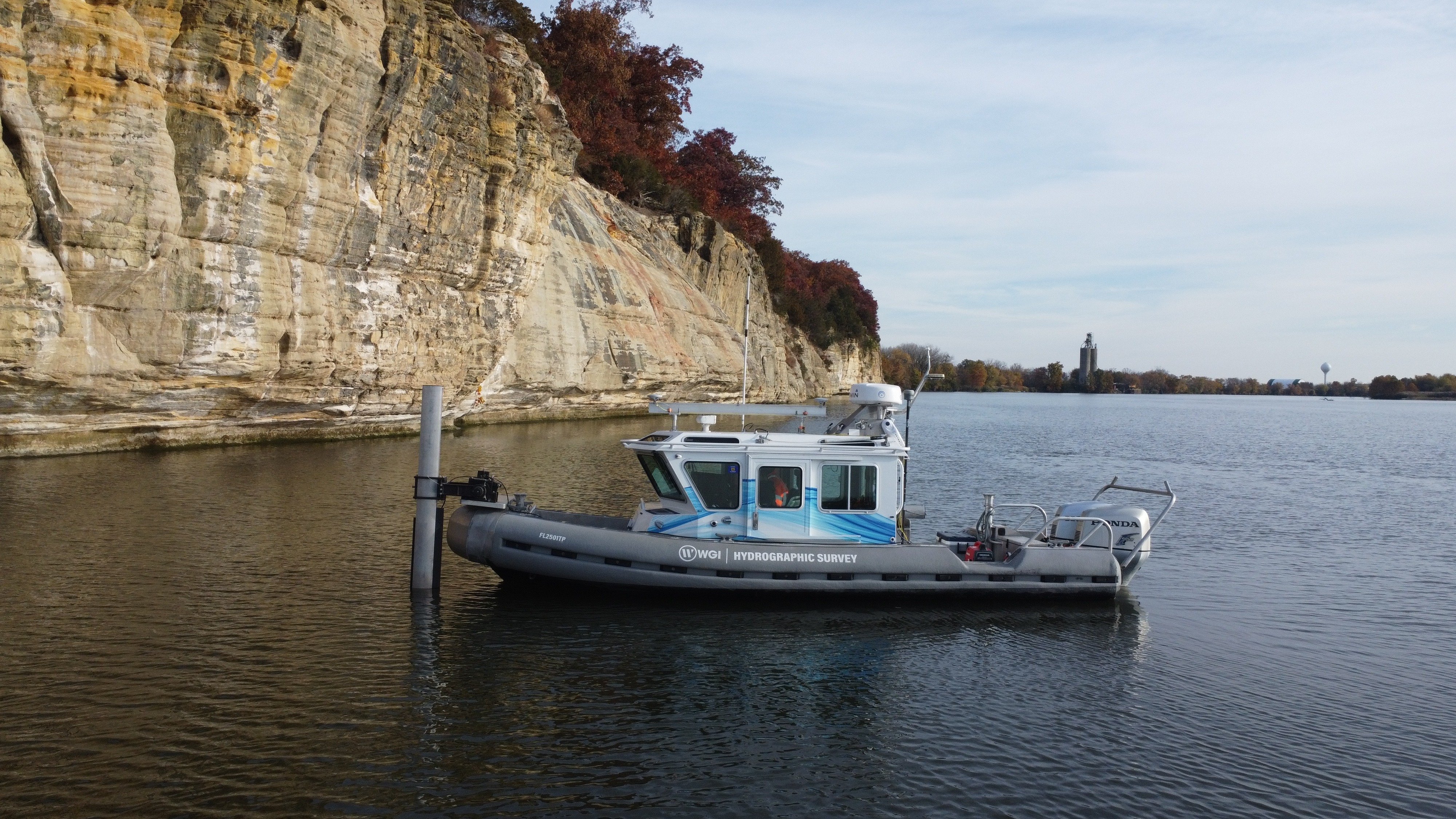
Integrated Sensor Systems
Download Free Whitepaper
Depth Range
Scroll
The Problem

The gap between what agencies expect and what real waterways demand

A persistent gap exists between what many agencies and municipalities expect from a hydrographic survey and what modern aquatic environments actually require. A typical inland river system spans 40+ foot navigation channels, mid-depth floodplain zones, backwaters below 3 feet, and wetland margins that no single acoustic or optical technology can address effectively. That gap — between single-method survey thinking and the multi-sensor reality of complex water bodies — is where projects succeed or fail.

Four systems. One integrated dataset.

Multibeam Sonar

Complete bottom coverage in navigable depths with acoustic swath geometry. Achieves vertical accuracy within 10 cm under USACE standards. Optimal above two-to-three times vessel draft.

Single Beam Echosounder

Extends coverage into shallow zones, constricted waterways, and obstructed areas. Dual-frequency 200/24 kHz adapts to varying depth and turbidity conditions where multibeam cannot reach.

Airborne Topobathymetric Lidar

Green-wavelength laser penetrates optically clear water, creating continuous elevation data across the land-water interface — uniquely bridging terrestrial and submerged environments.

Side Scan Sonar

Acoustic imagery of the riverbed reveals substrate variations, scour conditions, submerged debris, and habitat features that depth measurements alone cannot capture.

Multibeam matrix in the Starved Rock Pool of the Illinois River
Multibeam Matrix — Starved Rock Pool, Illinois River

Upper Mississippi River System, Illinois River

WGI deployed a comprehensive multi-sensor suite for USACE's St. Louis and Rock Island Districts across 356 square miles of dynamic riverine environment — spanning 40-foot navigation channels down to inaccessible backwater zones.

Multibeam coverage — Peoria Pool644.55 NMi
Multibeam coverage — Starved Rock Pool194.84 NMi
Multibeam vertical RMSE0.069 m
Single beam vertical RMSE0.094 m
GNSS control observations564

What you'll take away from this research

01
Technology

Why single-method surveys fail complex water bodies

A clear breakdown of the operational envelope and failure conditions of each survey technology — where they perform and where they don't.

02
Integration

The data integration challenges that make or break a project

Vertical datum consistency, transition zone validation, motion correction protocols, and QC documentation requirements that agencies often underestimate.

03
Procurement

What to specify before you scope a hydrographic survey

Practical guidance for owners and agencies: how to define end-use requirements, account for full depth ranges, and verify accuracy assessment methodology.

04
Standards

USACE EM 1110-2-1003 and what it actually requires

The governing federal standard for hydrographic surveying and how its multi-technology specifications are routinely misread in survey scopes.

05
Case Study

Applied methodology at scale: the Illinois River project

A detailed look at instrument configuration, operational constraints, accuracy results, and lessons from 356 square miles of multi-sensor field work.

06
Deliverables

What a complete, project-ready bathymetric dataset looks like

LAZ, XYZ, and ASCII multibeam formats; side scan GeoTIFFs; one-meter surface grids; bottom-type classifications; and FGDC-compliant metadata.

Aerial sonar survey map — Peoria Pool, Illinois River
"The difference between data that supports confident decision-making and data that creates uncertainty — is the multi-sensor approach."
— WGI

Get the Full Whitepaper

Complete the form to receive immediate access to Mapping the Full Water Column — a technical resource for engineers, project managers, and agency professionals navigating complex hydrographic survey decisions.

Mapping the Full Water Column Whitepaper Cover

Mapping the Full Water Column

Why Modern Hydrographic Surveys Require Multi-Sensor Integration

Access the Research

You're all set.

Your copy of Mapping the Full Water Column is ready. Click below to download.

Download PDF
LET'S TALK.
Talk to an Expert

Questions about your survey project?

Coty Granger
Coty Granger
Project Manager — Hydrographic Surveying
[email protected]
Mark Topping
Mark Topping
Client Solutions Manager
[email protected]
Chris Cannon
Chris Cannon
Project Manager
[email protected]
Stephen Clancy, PLS, PSM, GISP
VP, Division Leader
[email protected]